
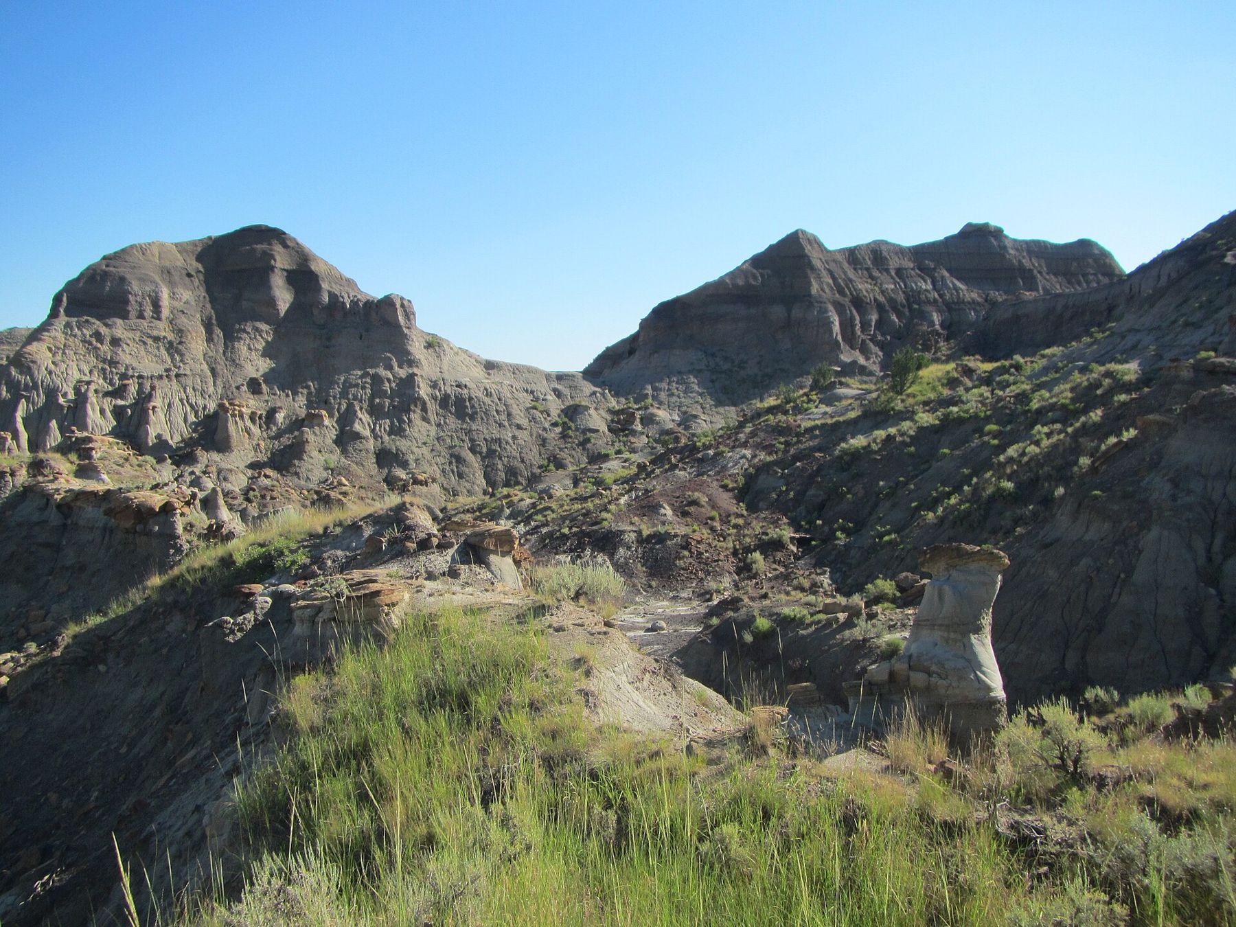
On the edge of Glendive, in eastern Montana, the prairie breaks open into a maze of gray and buff ridges, hoodoos and pine-dotted coulees. This is Makoshika State Park, the largest state park in Montana, and its rocks run straight through the end of the age of dinosaurs. The name comes from a Lakota phrase usually translated as bad land or bad earth, and anyone who has tried to cross ground like this on foot will understand why.
For visitors, Makoshika is the easy way into the same rock that made Hell Creek famous. You can drive in from town, walk marked trails, and see the line between the dinosaur world and the one that followed, without needing a four-wheel-drive vehicle or a land-ownership map.
Two formations and a boundary
The lower slopes in the park belong to the Hell Creek Formation, laid down by rivers and swamps near the end of the Cretaceous period. The upper slopes, often with darker bands, belong to the Fort Union Formation, which formed in the early part of the age of mammals. Between them lies the boundary that marks the mass extinction about 66 million years ago.
That boundary does not announce itself with a sign on every hill. It is a subtle change in color and texture, sometimes near a thin coal or clay layer, and geologists still debate exactly where to draw it in some places. Interpretive panels and the visitor center help you learn its look, and once you spot it on one slope, you will start finding it on the next.
Triceratops and other finds
Dinosaur remains found in the park include Triceratops, the most common large dinosaur in Hell Creek rock, along with other dinosaurs and the turtles, crocodile relatives and fish that shared their rivers. Few visitors see bone in the ground on a casual walk, but the visitor center near the entrance displays fossils from the park, including a Triceratops skull, and explains how they were found.
The park is a stop on Montana's dinosaur trail, a network of museums and parks across the state, and it pairs well with the bigger collections at the Museum of the Rockies in Bozeman. Seeing the specimens there, then walking the rock they came from here, makes both visits richer.
On park land, research is done under permit by trained crews. When a skeleton is found, it is mapped, photographed and wrapped in a plaster jacket before it is lifted, so that its position in the rock is never lost. That record matters as much as the bone, because it tells researchers how close an animal lived to the extinction boundary.
Walking the badlands
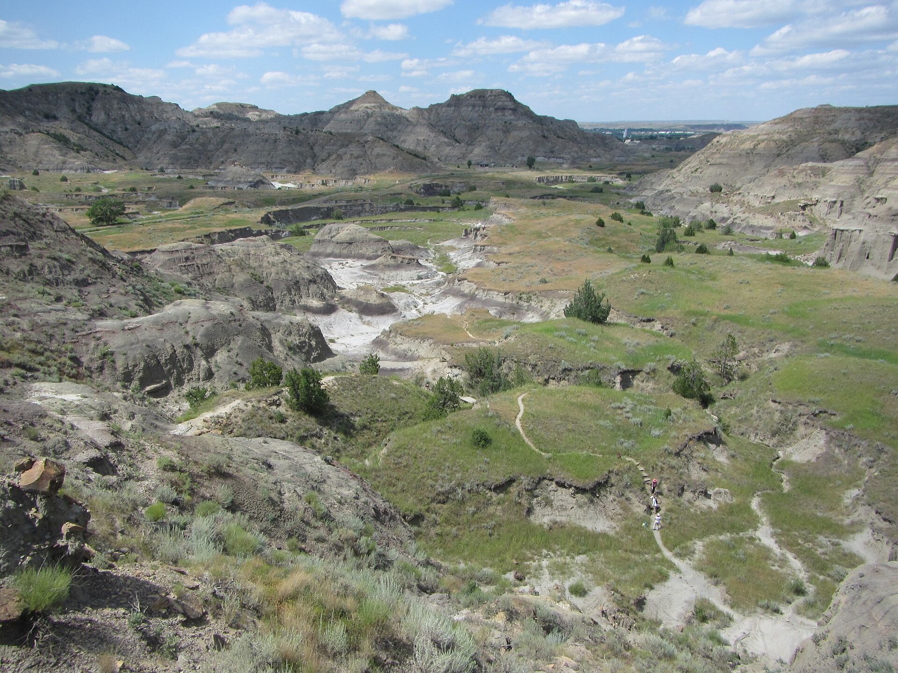
Several short trails leave from the park road. Some are easy loops of a mile or less; others climb steeply onto ridges with wide views over the badlands. Look for capped hoodoos, where a hard sandstone layer protects the softer clay beneath, and for the small arches and windows that wind and rain have cut through thin ridges.
Take a few minutes at any viewpoint to trace a single layer along the hills with your eye. A brown sandstone ledge on one ridge often reappears on the next at the same height, because these layers were once continuous sheets spread across the plain before rain and wind carved them apart.
The clay here behaves in two ways. Dry, it is hard and crumbly underfoot, with a puffy, popcorn-like crust on the surface.  Another trek · Northern RockiesThe Wall of Bones at Dinosaur National Monument Wet, it turns slick and sticky, and steep paths become dangerous. Stay on marked trails, step back from crumbling edges, and avoid climbing the softer slopes, where boot scars last for years.
Wildlife is part of the walk. Mule deer browse the coulees in the early morning, birds of prey ride the updrafts along the ridges, and the ponderosa pine and juniper on the north-facing slopes give welcome patches of shade.
Heat, storms and timing
Summers in eastern Montana are hot, and the badlands reflect heat back at you. Walk early or late in the day, carry more water than you think you need, and wear a hat. Afternoon thunderstorms build quickly over the plains in summer, bringing lightning and sudden downpours, so get off exposed ridges when you hear thunder.
Spring and early autumn are gentler, with cool mornings and soft light on the ridges. Winter can be bitterly cold, and the unpaved parts of the park road may be closed or unsafe after snow or rain. Rattlesnakes live in the park, so watch where you put your hands and feet. Check road and trail conditions before you go.
Glendive and getting there
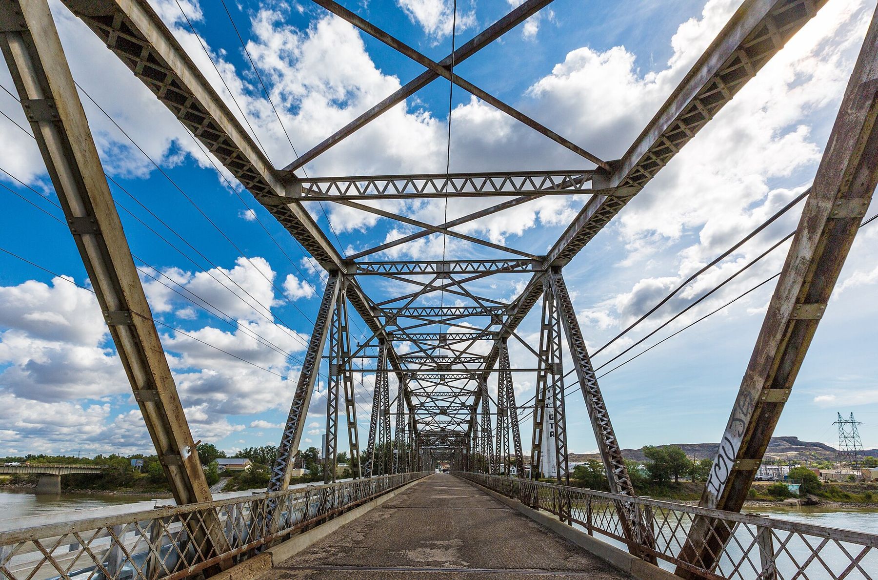
Glendive sits on Interstate 94 in eastern Montana, on the Yellowstone River, and the park entrance is at the edge of town. The town has fuel, groceries and places to stay, which makes Makoshika one of the easiest badlands in the region to visit. The historic Bell Street Bridge, an old steel truss across the Yellowstone, now carries walkers and cyclists and is worth a stroll in the evening.
Glendive also makes a natural link to the badlands farther afield. From here, roads lead west toward Fort Peck Lake and the Hell Creek country, and north toward the Canadian border and the Alberta badlands beyond, where the same kind of river-plain rock holds dinosaurs of its own.
The park has a campground and picnic areas. Day-use and camping fees apply to many visitors, and seasons and rates change, so check before you go. Plan your route with the rules for finding fossils in mind, especially if you go on to explore public land elsewhere in eastern Montana.
The photographs on this trek were shared under open licences; their photographers are named in Who shot the bones.